Monitoring drone developments in the nuclear sector
7 April 2022Drones are becoming commonplace and are increasingly being used for radiation monitoring. Judith Perera reviews some recent projects and developments
Companies worldwide are designing and promoting unmanned aerial vehicles (UAVs) and unmanned aerial (or aircraft) systems (UAS). They have multiple uses from defence and weapon delivery to surveillance and aerial photography — and for personal use they can even be purchased online. Increasingly they are now being developed to help with radiation monitoring — especially since the 2011 Fukushima disaster.
Following the accident at Japan’s Fukushima Daiichi nuclear power station, in 2012 the International Atomic Energy Agency (IAEA) and Fukushima Prefecture agreed to cooperate on radiation monitoring and remediation. The cooperation covered assistance in research and study on:
- Radiation monitoring, including the application of environmental mapping technology using UAVs, and using radiation monitoring data to develop maps to be made available to the public;
- Off-site decontamination, including analyses of environmental monitoring results and exploration of exposure pathways to reduce or avoid exposure;
- Managing radioactive waste including management methods for low-level radioactive waste from off-site decontamination activities.
A project on the application of environmental mapping technology and the use of radiation monitoring data to develop maps has since been completed and reports have been prepared by the IAEA and the Prefecture. The IAEA mid-term summary report (2013-2020) covered a wide range of activities, including “Application of Environmental Mapping Technology Using Unmanned Aerial Vehicles” to monitor areas that were inaccessible on foot or where high radiation levels were suspected.
The IAEA Department of Nuclear Sciences and Applications helped the Prefecture develop a methodology for using instrumented UAVs in two projects. This included providing a complete UAV-based instrumentation system capable of making radiation measurements, with the post-measurement analysis and interpretation methodology, as well as training Prefecture staff in the use of the UAV, its instrumentation and related software for data taking and analysis. IAEA said the established methodology “has a great potential to be expanded and applied in radiological mapping relevant to contaminated sites as a result of nuclear accidents, mining activities as well as part of decommissioning and remediation projects”.
In 2021, IAEA announced that its instrumentation and methodology for UAVs equipped with radiation detectors, cameras and GPS devices had been tested and validated under real conditions in the Fukushima Prefecture and was now available for practical use in routine or emergency situations. This included:
- A complete UAV-based radiation detection system with data processing and storage capability developed and built at the IAEA Nuclear Science and Instrumentation Laboratory (NSIL)
- Post-measurement analysis and interpretation methodology, with training at Fukushima Prefecture and at NSIL in Seibersdorf on how to apply the UAV and its instrumentation system, as well as on how to use the software for obtaining and interpreting data.
IAEA is currently working on integrating and testing improved instrumentation, including its adaptation to the next generation of UAVs. “These novel developments will allow both longer flight time of the UAV and determination of the dose equivalent rates and gamma spectra in a single measurement,” said Danas Ridikas, Head of the IAEA Physics Section. “When combined with high quality camera capabilities, the new system will allow obtaining a full 3D aerial photogrammetry model superimposed with the radiological maps and radionuclide identification.” UAV-based technologies will be crucial for advancing radiation monitoring, including improved environmental mapping and better long-term monitoring of contaminated areas, said Miroslav Pinak, Head of the IAEA Radiation Safety and Monitoring Section.
UAVs in Central Asia
IAEA also said in 2021 that UAVs would be deployed to monitor radiation at uranium legacy sites in Central Asia, including former uranium mining and processing areas in Kazakhstan, Kyrgyzstan, Tajikistan and Uzbekistan.
“Uranium mining and processing in this region between the 1940s and 1990s has left behind a number of radioactively contaminated uranium legacy sites,” said IAEA remediation safety specialist Sven Altfelder. He said that, as most of the sites are in mountainous and seismically active areas, monitoring with backpacks is challenging. This challenge was recognised by the IAEA’s Coordination Group for Uranium Legacy Sites (CGULS), which in 2017 partnered with experts from Germany, Kazakhstan, Kyrgyzstan, Tajikistan and Uzbekistan for a research project funded by the German Ministry of Education and Research to develop a drone.
The initial phase of the project was completed in 2020 with practical tests of the system in Ronneburg, Germany, where detailed contamination maps were obtained from flights over partially remediated uranium legacy sites. CGULS facilitated participation by Central Asian experts in practical workshops and coordination meetings and provided logistical assistance for field work. The UAV will carry a gamma spectrometer specially selected for its accuracy in detecting the presence and concentration of the radionuclides. It is now undergoing final testing.
Currently several other organisations and private companies in Europe, Russia and the USA are also developing UAVs for radiation monitoring.
Drone developments in the French nuclear industry
NUVIATech Instruments, a subsidiary of Vinci Construction has developed the NuEM DRONES G for environmental radiation monitoring. It is designed for surveying smaller areas to search for uncontrolled radioactive sources or potential contamination, or places with a hazardous dose level. It comprises a NaI(Tl) gamma spectroscopy probe, a high dose level detector equipped with two energy compensated GM tubes and a mini air sampler for air contamination measurement.
In 2021 Azur Drones announced an initiative with industrial nuclear engineering company AVNIR Energy for remote monitoring and detection of radiation leaks at nuclear plants, as well as at industrial sites at risk of contamination. Azur plans to offer the remote, autonomous radiation detection service across France and abroad. The platform will use Azur’s Skeyetech drone-in-a-box package, with AVNIR Energy’s Ionised Zone Inspection Device (DIZI) radiation sensor integrated into the craft and its operating system. Skeyetech is an autonomous drone that can fly day or night missions, with or without remote piloting. Rather than functioning as a Geiger counter, the onboard DIZI sensor works as a scintillation detector capable of detecting, measuring, and identifying radioisotopes.
Azur says this should allow operators to identify radiation leaks faster and will provide a complete measure of intensity and makeup from a distance. The system will be used as part of regular, real-time readings during autonomous drone monitoring of facilities. When radiation levels are detected by other means, the Skeyetech-DIZI combination can be deployed to collect full data from the area. “The integration of the DIZI sensor on the Skeyetech solution offers the possibility of carrying out radioactivity readings at any location on a site in complete safety,” said Azur Drones CEO Nicolas Billecocq. Azur said the service has already been used by an unspecified player in France’s nuclear power sector.
Switzerland’s Flyability: indoor drones for nuclear power stations
In August 2021 Switzerland’s Flyability launched Elios 2 RAD, an indoor drone equipped with a radiation sensor made specifically for inspections at nuclear stations. “The Elios 2 RAD represents the first chapter in our efforts to create indoor drones targeted specifically for each of our key verticals, accelerating our mission to use robots instead of people for dangerous indoor inspection jobs,” said Patrick Thévoz, CEO of Flyability. “The Elios 2 RAD has the potential to significantly reduce the need for inspectors to be exposed to harmful radiation or to the hazards of confined space entry for the purposes of conducting routine inspections.”
Elios 2 RAD is equipped with an energy Geiger-Muller detector and can detect radiation while in flight through Flyability’s piloting app. After the inspection flight, nuclear engineers can use Flyability’s Inspector 3.0 software to map the radiation along the flight path of the drone, showing the exact location of dangerous dose levels within a nuclear facility. They can also play back the inspection flight within Inspector 3.0, with dose rate measurements displayed synchronously on top of the video footage.
Flyability already has a strong presence at nuclear facilities around the world, where its Elios 2 has been tested. “Over 80% of US nuclear operators already use Flyability’s indoor drones for their visual inspections,” said Alexandre Meldem, vice president of sales at Flyability. “Now we can expand that support by allowing engineers to collect actionable, high quality dose data.”
In 2020, Flyability used its Elios drone at Chernobyl in Ukraine to collect visual data within Reactor 5 (which was never started up) to confirm that no nuclear fuel rods were present. Flyability says with the Elios 2 RAD, it would be possible to return and record the amount of radiation present throughout the entire site.
SCK CEN develops radiological monitoring drones
In Belgium, aeronautical firm Sabca and nuclear research centre SCK CEN have developed a technology that enables drones to be used to carry out radiological measurements without any human intervention. “That will result in a significant step up in terms of radiation protection,” said SCK CEN director general Eric van Walle.
“This project is the result of a public-private partnership between SCK CEN and Sabca. The drones will be first used as a preventive measure to study areas for potential radioactive contamination,” said Interior Minister Annelies Verlinden. “We are also preparing for possible remediation”. Sabca provides two types of drones – a fixed-wing drone that can fly autonomously for hours and the multicopter, which can carry heavier detectors without sacrificing flexibility.
For such work, a scintillation counter is attached to the drone. Johan Camps, head of SCK CEN’s Crisis Management and Decision Support unit said the major benefit of drones lies in their flexibility. “Drones allow us to chart every last nook and cranny, which is something we cannot achieve using measurements carried out by hand or from a helicopter.” Information is received in real-time from a larger number of specific locations. SCK-CEN and Sabca were awarded €1 million ($1.2 million) in government funding and are investing additional sums into the project.
UK projects: autonomous drones for radiological mapping
UK radiation detection specialist Kromek has joined forces with radiological mapping firm ImiTec to offer a drone-based Autonomous Airborne Radiation Monitoring system (AARM) which provides an accurate, affordable, and versatile low-altitude aerial radiation detection vehicle.
AARM is an unmanned aircraft system (drone) weighing less than 7kg with a payload of less than 1kg, which “represents a low risk of structural damage to buildings and the environment during its operation”. The drone carries several supporting sensors: positioning fixing (Latitude and Longitude) by multi GNSS (GPS and Glonass), number of satellites and height above mean sea level; temperature, humidity and pressure; embedded real-time clock providing time and date fix (GSM and GNSS available as back up); and a laser to determine height above the surface being monitored. The payload bay houses the radiation detector unit. Single and multiple Kromek CsI or CZT micro-gamma spectrometers, including the GR1, D3S and Sigma50, can be connected to one unit and work simultaneously to map radiation from both gamma and neutron emitting sources.
The AARM system also includes gamma spectroscopy and mapping software, flight training and set-up. It can be flown by line of sight or on pre-programmed routes. Each survey route is saved as a collection of GPS waypoints, altitudes and velocities that allows the same survey to be conducted repeatedly. Data is transmitted through a secure network to a dedicated base station server for real-time mapping of radioactive contamination or can be stored on an on-board mini-USB memory stick for subsequent downloading, mapping, and analysis.
The University of Bristol in the UK is meanwhile testing the use of UAV-Lidar (Light Detection and Ranging) in the Chernobyl Exclusion Zone (CEZ).
The university is undertaking several robotics projects in close partnership with local Ukrainian institutes to address the need for radiation mapping in the CEZ.
Professor Tom Scott, project leader, said: “This unique environment also allows us the opportunity to test novel fixed-wing unmanned aircraft systems equipped with radiation mapping capability to demonstrate that, in the event of a nuclear incident, it could be possible to use a UAS instead of manned aircraft to provide real-time situational data about the spread and intensity of the radiation.”
Dr Kieran Wood, project aerial-robotics specialist, said one of the research targets is to develop a more accurate method to map the radiation pattern in an area.
“Part of this process requires a high-accuracy 3D model of the physical structure and terrain, and Lidar is an ideal choice for 3D mapping in complex terrain. Since most of the radioactive material is contained in the ground, we also needed to have a bare-earth model only, and post-processing the Lidar can provide this with high accuracy.”
Besides mapping with the gamma and Lidar sensors, the UAVs are equipped with cameras which enabled the team to collect photogrammetric image sets in parallel.
The primary measurement is gamma radiation intensity. Wood explained: “By fitting a gamma detector onto a UAV and flying above the terrain, variations in the measured gamma intensity can be mapped, then post-processing enables interpolation of the measurements into a complete map. The localisation then became relatively simple, since the hotspots were clearly indicated by very localised peaks in the measured radiation intensity.”
“The measurements are all geotagged with GNSS receivers, hence the visual interpretation of the gamma map can tell us the longitude and latitude of the radiation hotspots,” Wood added.
Norway and Russia develop drones for radiation monitoring
Norway is also deploying radiation drones along its coast. Five Coast Guard ships will carry drones with sensors capable of detecting radioactivity in case of a maritime accident involving a potential release from a reactor-powered vessel.
The cooperation agreement between the Norwegian Coastal Administration and the Radiation and Nuclear Safety Authority includes reporting and monitoring in the event of incidents that involve a risk of contamination.
Radiation is a concern in the Arctic because the region served as a dumping ground for radioactive materials, was a testing site for nuclear weapons during the Cold War and houses actual and potential sources of contamination, the Arctic Council points out. Arctic pollution levels are regularly assessed through monitoring by the Arctic Council’s Arctic Monitoring and Assessment Programme.
Russia is also developing drones for radiation monitoring. In July 2021 Roskhimzashchita (part of Russia’s state corporation Rostec) presented the Shmel (Bumblebee) universal air gas analyser intended for installation on UAVs. The online device can detect substances in the air, measure background radiation and transmit the data to the online system.
The gas analyser has eight chemical sensors to determine the concentration of pollutants, as well as to measure background radiation. The device provides automatic transmission of parameters and concentrations of hazardous chemical hazardous substances using permanent radio communication and binding to the GPS/Glonass system. The production will be deployed at Roskhimzashchita’s St Petersburg enterprise GosNIIkhimanalit. Serial production will begin in 2022. Production is planned at the level of 500 items a year. If there is an increased demand, the enterprise can increase its capacity to more than 1000 devices a year.
The system weighs less than 0.5kg and because it is small 18x12x6cm it can be installed on most drones. Its configuration can be changed in accordance with customer requirements by increasing the size of the gas analyser and installing more sensors to determine the concentration of pollutants.
Drones in the USA
In the USA, drone companies have partnered with radiation instrument manufacturers to develop robust systems capable of carrying the necessary payloads. The Electric Power Research Institute (EPRI) and power utility Exelon have demonstrated the use of an autonomous drone to map radiation levels and inspect equipment at Peach Bottom 1 (inoperable since 1974), and its low-level waste storage facility.
RADeCO provided the radiation detection instruments for the demonstration, and Exyn Technologies the autonomous drone navigation system.
Exyn said its multi-sensor data fusion autonomy engine, enables drones to navigate and adapt to complex, dangerous environments in real-time without GPS or a human pilot. Custom sensor integrations are available to overlay readings, such as radiation, gas monitor, IR, heat maps, chemical detection, and more.
The team made software and hardware changes to connect the radiation detectors with the drone and navigation system. The drone created high-resolution 3D maps of several areas inside using Lidar technology. As it flew to various locations, the radiation detectors collected readings every three seconds, displaying the results on the 3D maps. A video camera simulated the inspection of various components. Electric heated blankets were wrapped around pipes, and the drone’s infrared camera detected the elevated temperatures. To test the drone’s ability to avoid obstacles, a worker walked in its path and was immediately detected by the drone, which safely flew around him.
The Peach Bottom demonstration was part of EPRI’s Next Generation Radiation Protection (NextGen RP) initiative, which is examining various ways to streamline radiation protection and reduce worker radiation exposure. EPRI is also researching further uses of autonomous technology in the nuclear industry including: smaller drones to allow access into tighter areas of the plant, surface vehicles for the collecting of smears for contamination surveys and outdoor drones to support a plants’ emergency plan.
Other technology companies are also developing radiation sensors which can be used with drones.
Mirion Technologies is working with several drone and robot companies to offer this type of solution. These UAVs (or robots) can be equipped with various radiation detection instruments, such as the SPIR-Explorer to provide real-time radiological data through the flight control system and SPIR-Ident software. As the UAS collects data, the user on the ground receives a live stream of colours and GPS tags that shows the strength of the radiation, as well as a map of where it is coming from. The system can even extrapolate measurements at ground level using height information. With Smart Robotics systems, Mirion also provides autonomous radiation sensing systems including batteries, GNSS, and redundant no-loss transmission means that it can be mounted on any drone, robot, or vehicle.
At the end of 2021, US Nuclear became the first drone vendor to join the RAD-Responder Network, to report realtime drone data to US Department of Energy (DOE), National Nuclear Security Administration, Defense Threat Reduction Agency, Environmental Protection Agency, Federal Emergency Management Agency, and Air Force. US Nuclear partnered with the Ohio Department of Health (ODH) Radiation Emergency Preparedness Team to conduct a multi-agency flight training showcasing its ability to fully integrate its radiation payload data by connecting directly to the RadResponder Network.
The training exercise involved a DroneRad system flying a perimeter around crashed vehicles to measure, map, and report the fallout from a radiological hazard. DroneRad flew an automatic search pattern, with colour-coded mapping software able to exactly pinpoint the hazard. US Nuclear’s drone systems feature a seven-hour flight time and range of up to 10 miles depending on local regulations.
Curtiss-Wright Corporation announced an agreement with Teledyne FLIR Defense to supply unmanned systems and integrated solutions to the US nuclear power market and DOE. Mobile unmanned systems play a critical role by automating operations and eliminating the need for humans to perform tasks in hazardous conditions, it said. ¦
 NX160 equipped with SPIR-Explorer to provide real-time radiological data through the flight control system and SPIR-Ident software (Photo credit: Mirion)
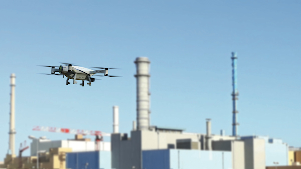
 Drones have been developed by the IAEA for use by the authorities of Fukushima Prefecture in Japan Photo credit: Fukushima Prefecture
 Skeyetech autonomous drone has been deployed on the Orano La Hague site since early last year (Photo: ©Azur Drones)