AN UNMANNED AERIAL VEHICLE (DRONE) is a flying machine without a pilot on board. Such drones may be remote-controlled, flying a pre-programmed route, tracking an object or person or have some other decision-making capability on board. They can carry a range of sensors and many can transmit data to the controller in real time. Some use multiple horizontal propellers; others look more like small fixed wing aircraft. The description unmanned aerial system (UAS) is preferred in some quarters to recognise that many use extensive ground facilities and some utilise a fleet or swarm of drones.
Drones have been used for wide area and site surveys with a range of sensors including visual, thermal, LIDAR, magnetic and ionising radiation, either individually or in combination. Their field of view and ability to cover ground rapidly, independent of the quality of the terrain, give them advantages over ground-based technologies. Coupled with accurate recording of their position and orientation, and post-processing of the data, they can reduce the cost and duration of surveys while increasing the scope.
They have been used for projects including: monitoring of sites and pipelines; detecting leaks, corrosion, movement or interference; monitoring building sites for programme management and PR purposes (as at Hinkley Point C); monitoring coral health and coastal erosion; and monitoring the spread of rhododendrons in Scottish woodlands.
In the nuclear industry application of this technology for radiation survey was accelerated by the Fukushima accident. In this case the tsunami destroyed the land-based radiation monitoring system, leaving the responders uncertain of the off-site dispersion of radioactivity and the best steps to take to protect the public. Vehicle and airborne surveying gave the first clear pictures of the situation and continues to this day, tracing the changes in isotopic distribution and dose rates with time and as a result of interventions.
For airborne systems the minimum detectable levels and the spatial resolution achievable depends on their ground speed and altitude. Slower, lower systems give better results, so a layered approach is optimum for large areas. A fast vehicle performing a high rapid survey and slower ones nearer the ground add detail in interesting areas.
There are a number of options for the detector. The choice depends on the weight lifting capability of the drone, the isotopes and concentrations expected on the ground and the purpose of the survey. Finding sources, mapping dose rates and mapping isotopic composition, all require to different options.
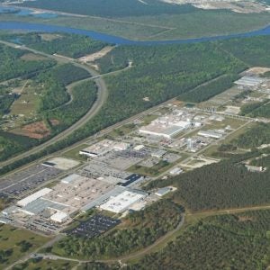
Dose maps of a storage compound in Sellafield were obtained in 2016 using a 1cm3 cadmium zinc telluride crystal detector, gimbal-mounted, with a laser range finder to measure elevation, coupled to a differential GPS on an autonomous 7kg drone. The technique has also been used to survey waste sites in Fukushima (Figure 1).
Drones can also be an ‘eye in the sky’ providing video views in real time and able to communicate with those on the ground or at sea. Applications have included first response to medical emergencies (delivering first aid equipment, visual and two-way voice communication with those on the ground); helping keep swimmers safe off Australian shores by using drones for shark watch, deploying rescue devices and communicating with those requiring assistance; and making mine clearance operations more effective and less risky. They are now routinely used by the emergency services in cases of search and rescue, investigation, hazardous material response, large open fires and complex structural fires. They can be used to detect and deter trespassers and are being used by UN peace keeping forces to track armed groups in dense terrain. Drones can also play a vital role in disaster response.
Nuclear emergency response applications could include deploying drones into the downwind sectors of a damaged site to provide real-time information on the radiological impacts in support of decisions on public protection. At the same time drones could be delivering stable iodine tablets within the affected areas and warning people such as farmers and ramblers who are in areas subject to countermeasures, but hard to contact.
Drones play a growing role in site condition monitoring on nuclear sites. This includes providing records of sites using photogrammetry, which allow the site to be viewed from different angles (corrected for perspective and scale) and allow accurate measurement of the position of items viewed. Drones can survey the insides and outsides of dilapidated buildings that might be unsafe for people to enter. Building information models can be built from drone data and virtual reality systems can be used to ‘immerse’ the user in the data giving them a first-hand perspective of buildings and equipment that was previously unobtainable.
Ontario Power Generation has been using drones since 2015 and by March 2018, had a fleet of 18 drones and four pilots. A five yearly inspection of the plant’s containment dome traditionally required construction of a tall crane, an expensive, time-consuming operation with safety implications. They report that the first aerial survey took four days, with two further days on site. Unlike the traditional method the aerial survey provides a 100% photo record which can be referred to in the future.
A report from March 2017 describes an external survey of a 120m stack at Sellafield, required to provide information for demolition.
Drones had saved Dounreay around £100,000 by 2017, using a £6000 ‘off-the-shelf’ drone. It undertook visual surveys of buildings, avoiding the need for work at height.
Another cost-effective use could be to monitor the condition and security of sites left in care and maintenance — looking for signs of human, animal or vegetation intrusion and reviewing the state of buildings, security fences and drainage. The solution for this sort of monitoring is a ‘slothbot’ rather than a drone.
The Nuclear Decommissioning Authority (NDA) has supported the development of a remotely operated drone with novel radiation mapping software and collision avoidance technology, which can fly into cluttered buildings. Remote Intelligence Survey Equipment for Radiation (RISER) has seen duty inspecting the Windscale Piles and in Fukushima, inspecting the previously inaccessible upper floors of reactor buildings.
Flyability used a collision-tolerant drone for the annual survey of underground tank rooms at a nuclear power plant. By capturing a panoramic video of the entire tank rooms for later analysis they saved time, worker dose and contaminated waste generation. They saved a further $456,000 by avoiding the need to reduce reactor power for the inspection.
Drones have also been used for long range missions. This includes delivering medical supplies to remote hospitals in Africa. The UN is investigating the potential of drones to carry humanitarian aid, while the IAEA has been using them to distribute sterile mosquitoes. This capability could be useful moving components and supplies, particularly in a post-accident situation.
Drones are no longer limited to being passive observers. For example, they have been used to de-ice and clean wind turbine blades at a fraction of the time and cost other methods would require.
The wide range of military uses for drones provides more hints of their potential. There are also developments underway on unmanned underwater vehicles.
New developments are yielding better sensors, better communications, more on-board computing power and more developed land equipment. Airborne radiation detectors are likely to improve, with better resolution, efficiency and minimum detectable levels from new crystals and increased computing power for spectral analysis.
Autonomous?
EPRI anticipates two areas where autonomy will be developed: inspection; and image processing. The first is the ability to fly around a structure without human guidance and the second the ability to process the vast amounts of data collected and highlight the interesting bits. Combining these abilities we can envisage systems that repeat a given survey (radiation, hyperspectral, magnetic or heat signal) regularly or continuously, returning to a wireless charging base when needed, and raising the alarm only when a threshold is exceeded or there is an unexplained change.
The use of drones for inspection and monitoring inside and on the external fabric of buildings, and in the environment, will develop at pace. Development will be driven because these systems can reduce time and costs while improving the scope of work, allowing information to gathered in places where no other means are available.
A number of universities now offer modules on drone development, so there should be a good pipeline of skilled developers and a thirst for projects.
Barriers to the use of drones on site, particularly within buildings, include fears of damage to facilities and infrastructure, bans on using radio equipment on sites and fears of broadcasting sensitive information.
Developments designed to overcome these fears include collision avoidance, novel communications techniques and encryption, reduced need for specialist pilots and redundancy in design, so that the drones can land safely in the case of a partial failure or loss of communications.
Depending on system scope, the costs for a drone application is about £100k to develop a first in class system, and about £25k to replicate at other sites.
Peter Martin from the University of Bristol says “we have cracked a lot of the science, with a good range of detectors, reliable flying machines, remote charging and increasing mission autonomy. We now need to explore the potential applications and keep improving. We will only be prevented from achieving the full benefits of drone technology by failure of imagination — rather than serious cost and technical barriers.”
Author information: Keith Pearce, Owner and Principal Consultant, Katmal Limited


